Posts

Showing posts from March, 2018

Wayne

Image
WAYNE - Founded 1880. Formerly "Louella" - Renamed for General Anthony Wayne. This community located on the Main Line west of Philadelphia is near where Anthony Wayne was born in 1745. Sources and Links: USHistory.org - General Anthony Wayne Main Line Homes - History of the Philadelphia Main Line

Ardmore

Image
ARDMORE - Founded 1873. Formerly "Athensville", renamed Ardmore in 1873. The name Ardmore comes from an Irish town of the same name. Located on US 30 about 10 miles west of Philadelphia, Ardmore is one of the famous and affluent Main Line communities that were originally served by the Pennsylvania Railroad's Main Line, which ran from Philadelphia to Bryn Mawr (later to Paoli). Downtown Ardmore is a shoppers' mecca, when one of the earliest official shopping centers in the United States, Suburban Square, opened in 1928. Because of Ardmore's status as a shopping destination, it has been given the nickname of the "Main Street of the Main Line". Sources and Links: Visit Philadelphia - Ardmore Destination Ardmore - Welcome to Destination Ardmore Main Line Homes - History of the Philadelphia Main Line Ardmore Waterford - Explore Ireland's Ancient East - Ardmore, County Waterford

Tri-State Rock

Image
Tri-State Rock (Monument) notes the point where Pennsylvania, New York, and New Jersey meet - even if it is 475 or so feet away. It's not often you can locate the spot where three states meet.  And if you want to go to the exact spot where Pennsylvania, New York, and New Jersey meet well you'd have to take a boat or canoe out to the middle of the Delaware River to find it.  However, for the non-adventurous, you can come pretty close to it, and there's a monument to go with it. The Neversink River (on left) flowing into the Delaware.  It is out here where the three states actually meet. Tri-State Rock is located in Port Jervis, New York and is the "unofficial" point where the three states meet.  The location of the Tri-Point is where two rivers, the Neversink and Delaware, meet.  Tri-State Rock is known historically as Carpenter's Point and a monument noting the tri-point has been in place here since 1882. There are actually two monuments located

McConnell's Mill State Park

Image
Located about 40 miles north of Pittsburgh, McConnell's Mill is one of the most popular state parks within Pennsylvania.  The park borders both sides of Slippery Rock Creek Gorge which was formed as a result of retreating glaciers during the Ice Age.  McConnell's Mill State Park is home to numerous outdoor activities.   Hiking, fishing, rock climbing, canoeing and whitewater rafting are very popular year round activities at the park.   Depending on the depth of the water, Slippery Rock Creek can be classified as a Class II or III rapid.   Most whitewater enthusiasts utilize an approximately six mile route from Rose Point to the Eckert Bridge.   Spring and fall are the most popular times for whitewater at the park. The centerpiece of the park is the former McConnell's Mill and dam.   The first mill at this site was a grist mill built by Daniel Kennedy in 1852.   This mill burned down in 1868 but was quickly rebuilt.   In 1875, Thomas McConnell took over ownersh

Old Mill Village Museum

Image
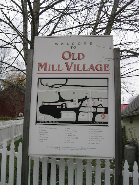
Old Mill Village Museum is an open air museum located just south of the Susquehanna County town of New Milford on PA Route 848 as a way to preserve the heritage of days gone by in the Endless Mountains region of Pennsylvania. The Old Mill Village Museum was founded in response to the Borough of New Milford's centennial celebration in 1959, as local residents wanted to honor and share the area's history. Land was donated along Meylert Creek on the historic Great Bend-Cohocton Turnpike (in part, today's PA 848), which once brought settlers and commerce to this part of northeastern Pennsylvania. Historic buildings were also donated and moved onto the land, with period artifacts collected for display on site. Local artisans were recruited to demonstrate the arts and skills of the days of yore. As a result, for over 50 years now, the Old Mill Village Museum has been open for people of all ages to learn about what life was like during the early days of New Milford in the 19

Raymondskill Falls

Image
Located within the friendly confines of the Delaware Water Gap National Recreation Area in Milford is Raymondskill Falls. Located on Raymondskill Creek, the three tiered waterfall is Pennsylvania's tallest waterfall at 178 feet tall. If you add the drops from each of the three tiers, the waterfall is just a few feet shorter than Niagara Falls , even if it may not feel quite like the waterfall is that tall. Still, it is a neat waterfall and definitely worth checking out. From the parking area off of Raymondskill Road, there is a trail at 0.3 miles in length that leads you to two viewing areas. One viewing area is for the lower area, so you can get a nice view of the falls. The upper viewing area allows you to look closely at one of the pools at the top of the falls. Sign at the trailhead on Raymondskill Road. Trail to the upper viewing area. Views from the upper viewing area leads to some smaller waterfalls. Side view from the top of Raymondskill Falls. Ano